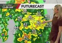
As we head into November, the weather in St. Louis is starting to shift from warm to cold, with the possibility of snow on the horizon. The earliest recorded snowfall in St. Louis dates back to October 20, 1916, when a tenth of an inch fell. The city saw its earliest recorded inch or more of snow on November 5, 1951, with 3.4 inches covering the ground.
In November, snowstorms in St. Louis typically start as cold rain, potentially accompanied by strong storms. As the storm system moves through and slows down, cold air moves in behind it, causing the moisture to transition into wet, slushy snow. This can sometimes result in a significant amount of snowfall in November.
Looking ahead, the cold air expected later this week may bring the first snowfall of the season to St. Louis. While it may be too early to predict the exact amount of snow, it’s always good to be prepared for winter weather in the coming weeks.
In addition to the early snowfall predictions, it’s important to remember to take necessary precautions when driving in winter weather. Snow and ice can create hazardous road conditions, so it’s best to drive carefully and allow extra time to reach your destination.
As we transition into winter, it’s always interesting to see how the weather patterns evolve and what surprises Mother Nature has in store for us. Stay tuned for updates on the upcoming snowfall and make sure to bundle up and stay warm as the temperatures continue to drop.


