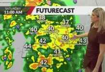
A prolonged period of active weather is expected to hit Missouri starting Saturday evening and lasting through at least midday Tuesday. This will bring multiple rounds of rain and thunderstorms to the region.
Although it won’t be raining the entire time, the most likely times for rain are late Saturday night into early Sunday morning, with much of Sunday expected to be rain-free. More waves of rain are predicted for Sunday night through early Tuesday.
The biggest concern with this weather system is the potential for excessive rain. Areas in southwest Missouri into central Missouri could see rainfall totals of six inches or more, while St. Louis may experience totals ranging from one inch to four inches. Most of the storms during this period are expected to be non-severe, but there is a possibility of stronger wind gusts with a line of storms on Monday night.
It’s important for residents in these areas to stay informed and be prepared for possible flooding and hazardous weather conditions. Remember to check local weather updates and follow any advisories or warnings issued by authorities.
In addition to the heavy rain and thunderstorms, there may be some disruptions to outdoor activities and travel plans during this period. It’s advisable to take necessary precautions and plan ahead to ensure safety and minimize any potential risks.
As always, it’s essential to stay safe during severe weather events by staying indoors, away from windows, and avoiding any flood-prone areas. Keep emergency supplies on hand, such as flashlights, batteries, and non-perishable food items, in case of power outages or other emergencies.
Overall, while the upcoming weather pattern may bring some challenges to the region, being prepared and staying alert can help mitigate any potential impacts. Stay tuned for updates and stay safe during this period of heavy rain and thunderstorms in Missouri.


