
The second big winter rainstorm is about to hit Los Angeles, bringing both hope and concern. After a devastating fire season, forecasters anticipate that this storm might be the turning point for the region. However, the risk of heavy rainfall triggering mudslides and debris flows in recent burn areas is a significant worry.
Timing and Impact
Los Angeles and Ventura counties are expected to experience widespread rain on Tuesday through Wednesday, with lingering showers possible on Thursday. The peak of the storm is predicted between 10 p.m. Tuesday and noon Wednesday. Although this atmospheric river storm is considered relatively weak, meteorologists caution about the potential for significantly higher rain amounts.
Forecasters are optimistic about the scenario for moderate rain, which could be beneficial for the area. However, there is a small chance of more intense rain, which could lead to hazardous conditions. On the other hand, San Diego, Orange, and Inland Empire counties are less likely to experience significant rainfall. Santa Barbara and San Luis Obispo counties are expected to see light rain over the weekend, with the peak rainfall time set from Tuesday at noon through 6 a.m. Wednesday.
In Northern California, three atmospheric river storms are expected to bring substantial rainfall and snowfall. This is crucial for jumpstarting the state’s water supply, especially after a dry January. The California Highway Patrol has already taken precautions by requiring chains for vehicles traveling over the Donner Summit on Interstate 80.
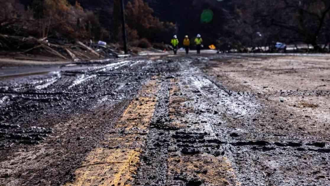
Risk of Mudslides and Debris Flows
Despite the potential benefits of the upcoming rain, there is a minor to moderate risk of debris flows and mudslides in the recent burn areas of L.A. County. The wildfires have made the soil water-repellent, increasing the chances of dangerous flows in the event of heavy rainfall. Areas like Pacific Palisades and Altadena, which were devastated by the Palisades and Eaton fires, are particularly vulnerable.
During the first major winter storm last weekend, mudslides and debris flows were already a concern, although the heaviest rainfall avoided the burn scars. The upcoming storm could pose similar risks, depending on the intensity of the rainfall. The potential for road flooding, rock slides, and erosion is heightened in sensitive areas, especially canyons and higher elevations.
Rainfall Predictions and Precautions
Rainfall totals for L.A. and Ventura counties are estimated to range from half an inch to 1.5 inches, with higher amounts expected in the mountains and foothills. Santa Barbara and San Luis Obispo counties could receive 1 to 2 inches, with more in the mountainous regions. Several scenarios are possible, with varying levels of rainfall and associated risks.
Preparations are underway to mitigate the impact of the storm. Governor Gavin Newsom signed an executive order to maximize water collection and storage in anticipation of the upcoming storms. The California Governor’s Office of Emergency Services is advising residents to stay indoors, avoid flooded roads, and be prepared for possible power outages. Authorities are also urging people living near burn areas to have evacuation plans in place and essential items ready in case of emergency.
As the region braces for the second big winter rainstorm, the hope is that it will bring much-needed relief from the devastating fire season. The balance between optimism and caution underscores the importance of preparedness and vigilance in the face of unpredictable weather patterns.


