Snowstorm to Sweep Through Mid-Atlantic States
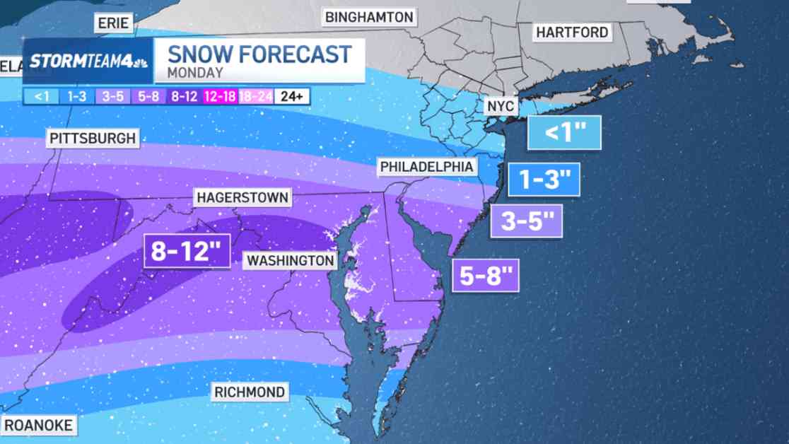
A powerful winter storm is on the horizon, set to unleash a deluge of snow, ice, and severe weather across a vast swathe of the nation. As we head into the final days of the weekend, this storm is making its way from the mid-Mississippi Valley towards the Mid-Atlantic region, where it is expected to wreak havoc come Monday.
Impacts Across the East Coast
The storm’s reach extends far and wide, with winter weather alerts stretching along its path. While Ocean County is anticipating a modest 2-4 inches of snowfall, the real brunt of the storm is predicted to hit further south, with regions like Kentucky, Ohio, West Virginia, Virginia, and Maryland potentially facing up to a staggering 10 inches of snow. Cities like Washington, D. C., and Baltimore are bracing themselves for the worst, as the storm threatens to paralyze ground and air travel alike.
Travel Woes for Tri-State Area
For residents in the tri-state area, particularly those with travel plans into South Jersey or along the I-95 corridor through D.C., caution is advised. Roadways are likely to become treacherous, and flight delays and cancellations are almost certain. If you have the flexibility, consider rescheduling your journey to a safer date.
Local Impact and Safety Measures
As the storm approaches, local areas like New York City and Central Jersey may experience light snowfall, but nothing too severe. However, with temperatures dipping below freezing, road conditions could deteriorate, prompting a need for increased vigilance and slower driving speeds. While the storm will eventually pass, the wintry aftermath will linger, necessitating caution and patience from all residents.
As we gear up for the impending snowstorm, it’s crucial to stay informed, stay safe, and look out for one another. Winter may be unrelenting, but together, we can weather any storm that comes our way.


