A lot of rain fell at Lambert Airport on Monday, a record-breaking 3.75 inches! This is the highest amount of rainfall in a 24-hour period for the month of November ever recorded. The previous record was set back in 1921 with 3.56 inches.
The heavy rain and storms are expected to continue into Tuesday morning as a cold front makes its way east across the bi-state area. This means that areas already saturated with rain will see even more soaking rains. The soils are completely saturated, and streams and creeks in the area are running very high and fast. Flooding is a significant concern for Tuesday. The rain should start to clear out of Missouri communities by lunchtime, with Illinois counties seeing the rain clear out slowly through the afternoon.
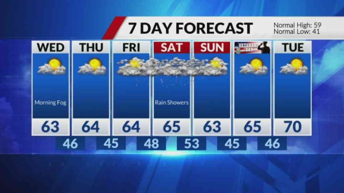
As we head into Tuesday night, the skies will gradually clear. We should keep an eye out for fog developing into Wednesday morning. The good news is that we have a few dry days ahead from Wednesday through Friday before rain chances return on Friday night.
With the heavy rain and storms finally moving out of the area, the cool and dry weather midweek will provide some relief from the wet conditions. It’s important to stay cautious of flooding in the already saturated areas and to be prepared for the foggy conditions on Wednesday morning. Enjoy the break from the rain while it lasts, as more wet weather is expected to make a return by the end of the week. Stay safe and stay dry!
