
Winter is not quite ready to release its icy grip on the tri-state area just yet. Following a recent snowfall, meteorologists are closely monitoring a series of winter storms set to affect the East Coast in the coming days.
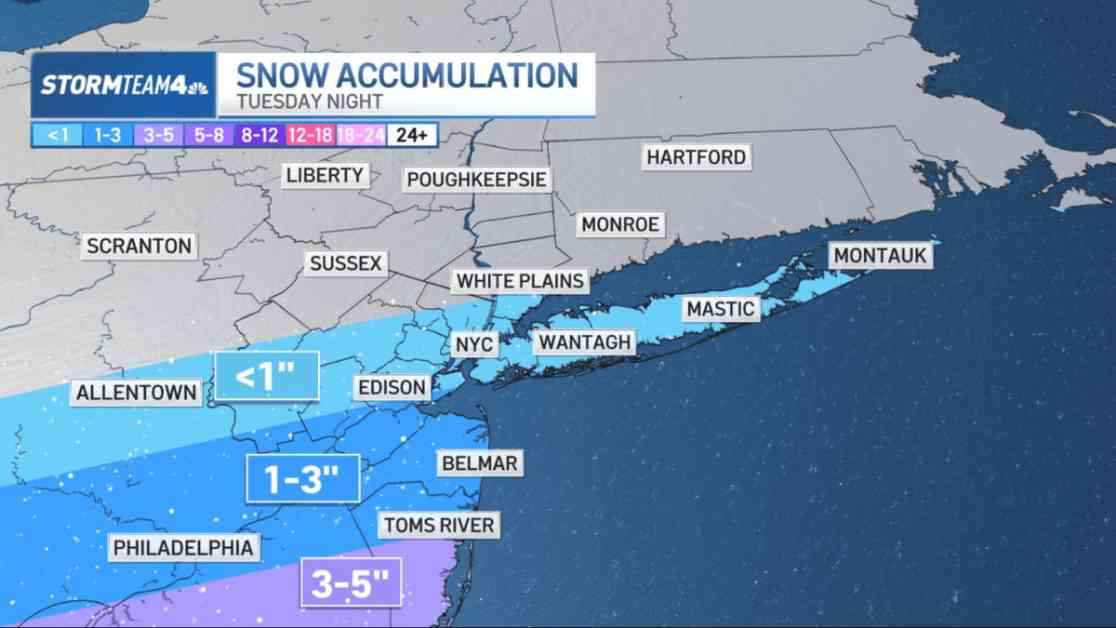
The first system is expected to move south of the tri-state region on Tuesday night, bringing with it the potential for several inches of snow in South Jersey. Meanwhile, New York City may only see minimal snow accumulation from this particular storm. However, Washington, D.C. and the Delmarva Peninsula are poised to receive a significant amount of snow, with snowfall totals possibly ranging between 5 and 8 inches.
In anticipation of the wintry weather, parts of Ocean County in New Jersey have been placed under a winter storm watch. As we know, small shifts in the storm’s track could lead to significant changes in the forecast, particularly for New York City. Therefore, it is advisable to stay informed and keep an eye out for updates from Storm Team 4 as the storm approaches.
Looking beyond the first storm, there is potential for a wintry mix on Wednesday night, Thursday morning, and once again over the upcoming weekend. While the exact timing and impacts of these subsequent storms remain uncertain, one thing is clear – temperatures are expected to remain cold throughout the week, signaling more wintry weather ahead.
In conclusion, it appears that the week ahead will be marked by unsettled weather conditions, keeping residents on their toes as they navigate the lingering grip of winter. Stay tuned for further updates and be prepared for whatever Mother Nature has in store.