
Winter Storm Alert: Tri-State Area Braces for Biggest Snowstorm in Years
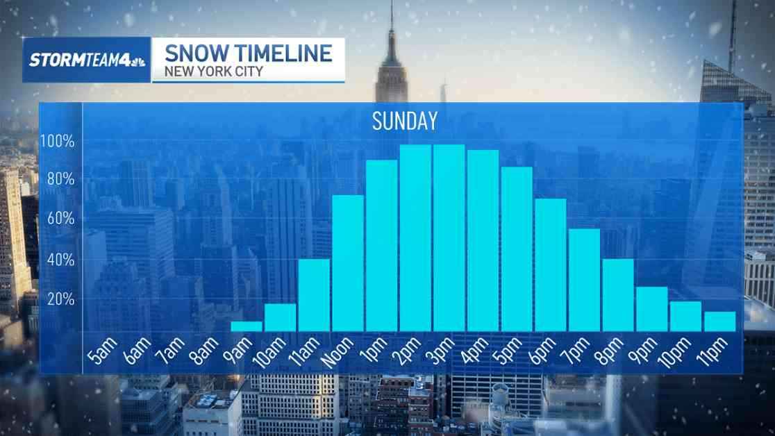
The tri-state area is gearing up for a significant winter weather event this weekend, with the biggest snowstorm in years forecasted to hit the region on Sunday. A winter storm watch has been issued for northeastern New Jersey, the Hudson Valley, and Fairfield County in Connecticut, with snow expected to move in before noon as temperatures drop below freezing.
Anticipated Snowfall and Impact
The impending snowfall is expected to bring varying accumulations across different parts of the tri-state area. In the New York City metro area, a general 3 to 5 inches of snow is forecasted, while further inland areas of northern New Jersey, upper Hudson Valley, and Connecticut could see 5 to 8 inches. Higher elevation regions in northwest New Jersey and the Hudson Valley might even receive up to a foot of snow.
While the exact snowfall amounts may vary depending on the storm track, residents are advised to prepare for plowable snow on Sunday. Shoveling and sledding activities are anticipated for Monday, so make sure to bundle up against the cold.
Deep Freeze to Follow
Following the snowstorm, a significant drop in temperatures is expected next week, with morning lows plunging into the teens and 20s. The coldest air of the season will settle over the region, particularly on Tuesday, Wednesday, and Thursday, when morning wind chills could reach sub-zero levels, posing potentially dangerous conditions.
The frigid temperatures are a stark reminder that winter is in full swing, with the end of January historically being the coldest time of year for Central Park. As the region braces for the impending snowstorm and bitter cold, residents are urged to take necessary precautions to stay safe and warm during this challenging weather period.