
New York City, a vibrant metropolis known for its hustle and bustle, is bracing for a series of winter storms that will bring snow, sleet, freezing rain, and ice to the tri-state area. After a dry January, February is ushering in a much messier weather pattern that is sure to disrupt daily routines and test commuters’ patience.
Snowy Start to February
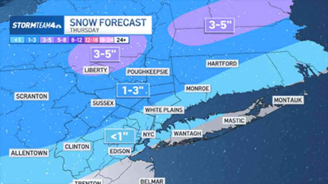
The first system is set to arrive early Thursday morning, just in time to wreak havoc on the morning commute. While not heavy, the snowfall will be enough to impact visibility and create slippery road conditions, urging caution for those venturing out. As the day progresses and warmer air moves in, the snow will transition into sleet, freezing rain, and eventually rain. The varying types of precipitation are dictated by the vertical temperature profile in different regions, with sleet and freezing rain occurring where warmer air overlays freezing surfaces.
Midday on Thursday will see the switchover from snow to ice, especially in northwest New Jersey and the Hudson Valley. While significant ice accumulations are not expected, even a light glaze can make surfaces dangerously slick. Further south and east, a quicker transition from snow to rain is anticipated, leading to a rainy evening commute that may still pose challenges due to melting snow and slush.
Snowfall totals remain uncertain due to the impending rain that will wash away some of the accumulation. However, the Hudson Valley and North Jersey could see an inch or more, while higher elevations in the mountains may receive over 3 inches of snow.
Weekend Woes and Midweek Snow
Following Thursday’s system, another round of wintry weather is forecasted for late Saturday into Sunday. While this storm won’t impact rush-hour commutes, it will complicate weekend plans with a mix of snow, rain, and ice. To avoid weather-related disruptions, it’s advisable to schedule outdoor activities early Saturday or late Sunday.
Looking ahead to the middle of next week, a final storm is expected to bring measurable snowfall to the tri-state area before transitioning to ice and rain. While the forecast may evolve in the coming days, current projections hint at a significant snow event that could blanket the region. This storm presents the best opportunity in the next 10 days for substantial snow accumulation across New York City and its neighboring areas.
As New Yorkers gear up for a winter onslaught, it’s essential to stay informed, exercise caution on the roads, and prepare for potential disruptions to daily life. With multiple storms on the horizon, residents are advised to stay tuned to weather updates, plan ahead, and stay safe amidst the wintry mix.