
Winter Chill in January Brings Hope for Snow Lovers
January 2025 has turned out to be an unexpectedly frigid month, with a staggering 16 days experiencing temperatures below freezing. With such bone-chilling conditions, one would expect snow to be piling up by the foot, right? Surprisingly, this has not been the case. In fact, this January has gone down in history as the driest on record in Central Park. To put it into perspective, records stretching back to the 1860s attest to this unprecedented dry spell.
Only a meager half-inch of liquid-equivalent precipitation has fallen, resulting in a paltry three inches of snow accumulation so far. However, the month is not over yet, and there is still a glimmer of hope for snow enthusiasts on the horizon.
**Anticipated Snowfall: A Detailed Look**
As we head into the upcoming week, weather forecasters predict four separate low-pressure systems will sweep through the region, each with varying degrees of strength. These systems could potentially bring a mix of snowflakes and raindrops, adding a touch of winter magic to the landscape. Keep an eye out for Tuesday morning, Wednesday morning, Friday, and Sunday as the days to watch for potential snowfall.
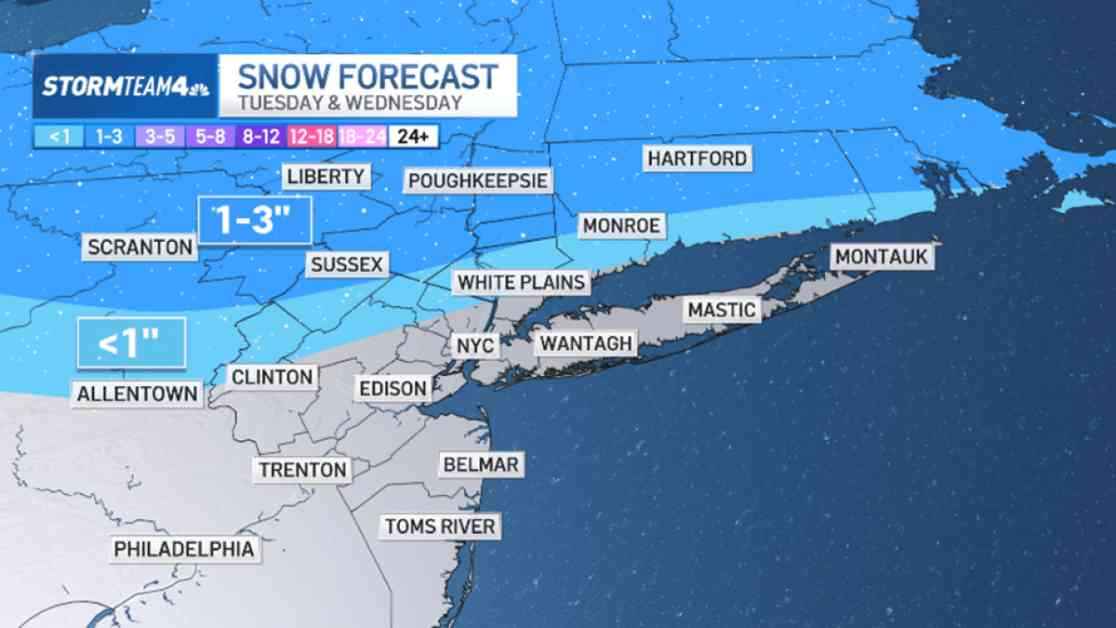
Tuesday morning may disappoint those hoping for substantial snow accumulation, as only flurries or a light snow shower are expected, with no significant build-up. Similarly, Wednesday morning could see light accumulations in the Catskills and Hudson Valley, ranging from 1 to 3 inches. However, for the city itself, little more than another round of flurries is on the cards.
**The Hope for Snow Accumulation**
Friday presents the most promising chance of precipitation, although temperatures are forecasted to remain above freezing for the majority of the day. This makes a substantial snowfall in the New York City area unlikely. Instead, residents may be greeted with a glaze of ice or possibly all rain. It’s still too early to predict with certainty, so be prepared with a raincoat and umbrella when venturing out on Friday morning.
A fourth low-pressure system is expected to hit the city on Sunday, marking the end of a week filled with weather activity. This system could potentially offer the best opportunity for snow accumulation. However, current forecast data suggests that snowfall totals would likely be less than an inch, dashing the hopes of snow lovers for a winter wonderland.
After Sunday, a dry spell is forecasted, indicating that significant snowfall is unlikely until well into February at the earliest. As we wait for more snow to grace our city, it’s a reminder to appreciate both the beauty and unpredictability of nature’s winter spectacle.