NYC Weather Forecast: Potential First Snowfall of the Season by Saturday Morning
New Yorkers, brace yourselves – snow may be on its way to the city this weekend. The anticipation is palpable as residents gear up for what could be the first measurable snowfall of the season. It’s been a while since we’ve seen that fluffy white blanket covering the streets of the Big Apple, so this news is definitely causing a stir.
Historical Context
Looking back at past winters, December snow in Central Park has become somewhat of a rarity in recent years. The last time we experienced measurable snow there was back in 2021, and even then, it was a mere 0.2 inches. Considering that the average snowfall is 4.9 inches, it’s safe to say that we are living in peculiar times – a phenomenon largely attributed to the effects of climate change.
Impending Snowfall
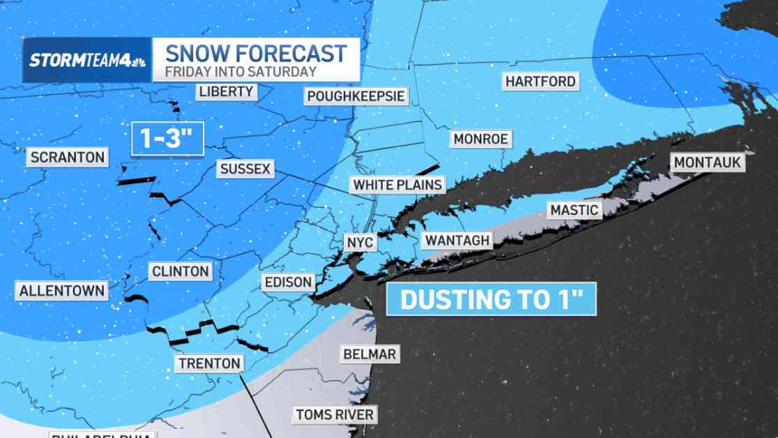
This year, there’s a chance for another tiny snowfall to grace the city, expected to arrive early Saturday morning courtesy of a quick-moving clipper system making its way through the tri-state area. While significant accumulations are not on the horizon, snowflakes are likely to blanket much of the region, including New York City. If freezing temperatures coincide with the clipper’s arrival, residents might wake up to a dusting of snow on Saturday.
Regional Variations
Areas further north and west of the city are likely to experience slightly higher accumulations ranging from 1 to 3 inches, owing to colder temperatures that facilitate snow sticking. Rain is forecasted to develop along the coast on Friday morning, with regions in northern New Jersey and the Hudson Valley facing a mix of rain and snow due to temperatures teetering near freezing. Meanwhile, the higher elevations of Northwest New Jersey, the Poconos, and Catskills are anticipated to witness an all-snow event.
Low-Impact Event
Despite the excitement surrounding the potential snowfall, meteorologists assure that this will be a low-impact event in terms of both timing and intensity. The clipper system isn’t expected to bring copious amounts of moisture, translating to light rain and snow accumulations. Snowfall projections remain modest, with most areas likely to receive under an inch and a maximum of three inches in certain regions.
As Saturday morning approaches, temperatures are set to dip to freezing in the city, Long Island, and Central & South Jersey, offering the perfect conditions for a dusting of snow. So, don’t be taken aback if you wake up to a delicate layer of white outside your window – it’s all part of the winter magic.
In conclusion, while this impending snowfall may not be the grand nor’easter snow enthusiasts yearn for, it promises to be a fitting welcome to the commencement of astronomical winter on Saturday morning. Stay tuned for further updates and relish the enchanting winter wonderland that awaits!
