
Title: L.A. County Faces Heightened Mudslide Threat: Urgent Call to Action
As the skies darken with impending rain, Los Angeles County finds itself on high alert for potential mudslides in areas ravaged by recent wildfires. Officials issued a grave warning on Sunday, cautioning residents of a 10% to 20% likelihood of significant flash floods and debris flows that could wreak havoc on roads and homes in and around fire-scarred regions. The National Weather Service’s meteorologist, Kristan Lund, underscored the urgency, labeling this impending natural disaster as the “worst-case scenario to prepare for.”
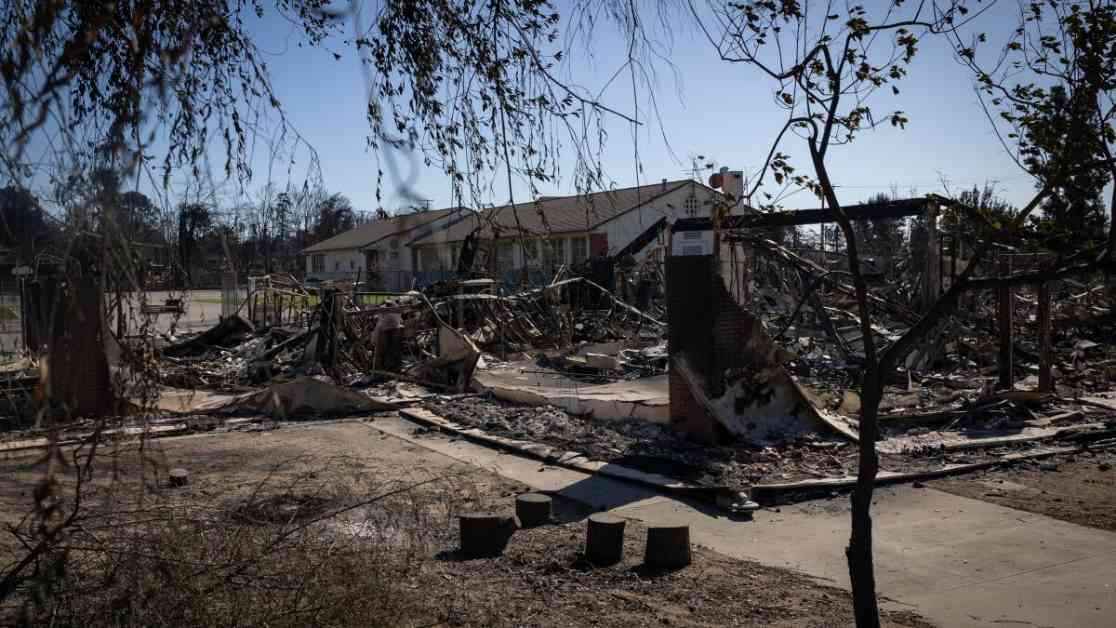
The Charred Footprint: Eaton Fire Haunts Los Angeles
Among the various burn scars, the aftermath of the Eaton fire poses the most imminent threat. Spanning over 14,000 acres, this charred landscape stands as a grim reminder of the destructive power of wildfires. Lund warned that flash floods and debris flows are most likely to occur in and around these burn scars, heightening the risk for vulnerable communities residing nearby.
Flood Watch Underway: Timing is Critical
A flood watch was implemented earlier than anticipated, kicking off at 10 a.m. on Sunday and extending until 4 p.m. on Monday. Regions impacted by this watch include Altadena, Pasadena, Pacific Palisades, Malibu, Lake Castaic, and the San Gabriel Mountains west and southwest of Wrightwood. The weather service pinpointed the window after 4 p.m. on Sunday as the period of highest risk for potential debris flows, urging residents to remain vigilant and prepared.
The Science Behind Mudslides: A Deadly Force Unleashed
Lund shed light on the mechanics of mudslides, emphasizing that post-wildfire conditions make the soil repel water, setting the stage for catastrophic debris flows. When intense rainfall inundates the scorched terrain, water rushes downhill, picking up rocks and debris along the way. This deadly force, known as a debris flow, can unleash devastation with unprecedented fury, posing a significant risk to life and property.
Nature’s Fury Unleashed: The Impending Storm
As the storm looms closer, forecasters predict escalating rainfall totals across Southern California. Covina, downtown L.A., Long Beach, Canoga Park, Santa Clarita, Fillmore, Redondo Beach, and Thousand Oaks are all poised to receive varying amounts of rain, heightening the risk for debris flows in these susceptible areas. The orientation of the terrain, coupled with the storm’s moisture patterns, creates a perfect storm scenario, amplifying the threat of heavier rainfall in the burn scar regions.
Precautions Urged: Safety Measures to Mitigate Risk
In light of the imminent danger, officials urge residents in fire-scarred zones to take proactive safety measures. From using sandbags to safeguard property to stocking up on essential supplies, preparedness is paramount in the face of potential road blockages and evacuation orders. The importance of heeding official warnings, clearing drainage paths, and avoiding contact with polluted runoff cannot be overstated.
Widespread Drought: A Climate Crisis Amplified
The severity of the situation is compounded by Southern California’s severe drought conditions, with some areas even classified under “extreme drought” by the U.S. Drought Monitor. This environmental crisis underscores the urgent need for collective action to address climate change and its devastating consequences on our communities.
As the storm gathers momentum, residents are urged to remain vigilant, stay informed, and prioritize safety above all else. By coming together and taking proactive measures, we can weather this impending storm and emerge stronger, united in our resilience against nature’s fury.