
Midweek Weather Brings Snow, Sleet, Ice, and Rain
The midweek weather forecast for the tri-state area took a wintry turn on Thursday as snow, sleet, and icy rain descended, creating slick conditions and prompting school districts to adjust schedules across the region. A winter weather advisory blanketed the entire tri-state area, except for eastern Suffolk County on Long Island and areas along the Jersey Shore coastline.
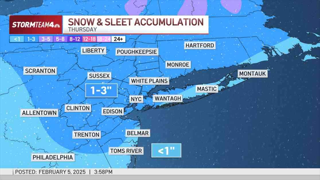
The weather system arrived in the New York City metro area in the early hours of Thursday, starting as light snow that reduced visibility and coated surfaces with a thin layer of snow, making roads slippery. Motorists were urged to exercise caution and allow extra time for their commutes, especially on untreated roads.
As the morning progressed, warmer air infiltrated the region, causing the precipitation to transition from snow to sleet, freezing rain, and eventually rain. The type of precipitation varied depending on the timing and location, with different conditions experienced across the tri-state area.
South Jersey experienced a brief period of sleet and freezing rain mixed with snow before transitioning to rain by sunrise. Early commuters encountered minimal snow accumulation, while those traveling closer to rush hour faced slushy conditions due to rising temperatures and rain.
Moving into north and central Jersey, there was an increased risk of light icing during peak commute hours, particularly on untreated surfaces like sidewalks, bridges, and roads. This icy layer compounded the initial snowfall, adding to the hazardous conditions for travelers.
Similar to South Jersey, New York City and Long Island also saw a brief changeover to sleet before transitioning to rain. However, the timing was slightly delayed due to the southern movement of warmer air, allowing snow to accumulate briefly, especially in western areas. By late morning, most areas experienced rain, resulting in slushy roads as the system departed.
Although icing amounts were not expected to be severe, even a thin glaze of ice could pose significant travel challenges. Wet surfaces could be deceptive, concealing hidden ice hazards for unwary pedestrians and drivers.
The Hudson Valley witnessed predominantly snow through Thursday morning, with isolated pockets of sleet and freezing rain as the system exited by late morning. Little to no changeover to rain was anticipated in this region, with snowfall totals ranging from 1 to 2 inches in most areas, and slightly higher amounts in elevated terrains.
While the snow and ice totals from this weather system were not anticipated to be extreme, the timing of the precipitation was expected to have a significant impact on travel and daily routines. Working from home was encouraged for those able to do so, and delays in school openings were likely for students across the region.
By the evening commute, the showers had dissipated, and much of the morning snow had begun to melt. However, residual snowmelt refreezing overnight could lead to slick or icy patches on roads, particularly in northern and western areas where temperatures were forecasted to drop below freezing.
Looking ahead, a brief respite was expected on Friday before another wintry system approached over the weekend, followed by additional rain, snow, and ice early the following week. The upcoming days promised a messy and active weather pattern, with Thursday marking just the beginning of a busy period for the tri-state area.