Santa Ana winds have calmed down after the Red Flag Warnings expired on Friday morning. The mountain areas might still experience a slight offshore gradient, but the coast will see the return of the onshore breeze.
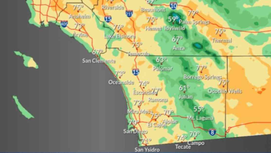
The weather for Friday and Saturday is expected to be clear, cool, and dry. There will be a brief warming trend in our inland valleys as a weak ridge of high pressure moves over the region. Daytime highs on Saturday will reach the low 70s along the coast, mid-to-upper 70s in the inland valleys, mid-60s in the mountains, and upper 70s in the deserts.
Even though the major wind event has passed, a dry and cold air mass will linger, leading to chilly evenings and mornings in the coming days. Overnight temperatures are forecasted to drop to the 40s for beaches, inland valleys, and deserts, while the mountains could see temperatures bottoming out in the mid-30s.
Looking ahead to early next week, a low-pressure trough is expected to move quickly into inland California. This trough will strengthen the onshore flow, bringing cooler temperatures to the region.
In summary, while the Santa Ana winds have subsided, residents can expect chilly nights and mornings due to the dry and cold air mass in place. The return of the onshore flow will lead to cooler temperatures next week, so it’s important to be prepared for the changing weather conditions. Stay tuned for further updates as the weather continues to evolve.
