
Cal Fire Updates Fire-Hazard Maps in Wake of Altadena Inferno
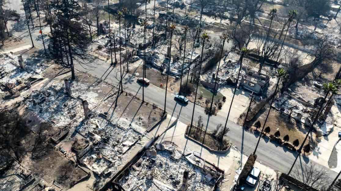
The devastating Eaton fire in Altadena has triggered a significant update to Cal Fire’s hazard mapping efforts. This tragic event, reminiscent of the Tunnel fire that claimed 25 lives and injured 150 individuals in 1991, has highlighted the urgent need for more accurate and comprehensive fire-risk assessments.
David Sapsis, an expert in fire science who witnessed the Tunnel fire firsthand, now leads Cal Fire’s hazard mapping endeavors. Reflecting on the Altadena blaze, he expressed concerns about the potential for catastrophic urban conflagrations under extreme weather conditions. This event has prompted a reevaluation of existing fire models and a call for more precise risk assessments.
First Street’s Advanced Fire Modeling
Prior to the Eaton fire, First Street, a public-interest climate risk assessment company, had identified Altadena as a high-risk area for wildfires. Their innovative fire model considers various factors, including vegetation, terrain, weather conditions, and the flammability of residential structures. Unlike Cal Fire’s static mapping approach, First Street’s model simulates how fires spread across urban landscapes, revealing vulnerabilities that traditional models overlook.
Jeremy Porter, an expert at First Street, emphasized the importance of understanding how houses can act as fuel sources during a wildfire. By incorporating physics-based fire spread dynamics, their model accurately predicted the extent to which fires could penetrate residential areas. The success of First Street’s approach has garnered attention from fire modelers, prompting discussions about its potential integration into future Cal Fire hazard maps.
Challenges in Fire Hazard Mapping
Despite the critical role of hazard maps in informing policy decisions and ensuring public safety, challenges persist in accurately assessing fire risks. Cal Fire’s conservative mapping strategy, which focuses on regulatory compliance rather than public awareness, has limitations in capturing the dynamic nature of wildfires. The agency’s delayed release of “moderate” and “high” hazard zones underscores the complexities involved in mapping fire risks across diverse landscapes.
David Sapsis acknowledged the evolving nature of fire hazard assessment and the need for continuous improvement. While existing safety regulations have proven effective in mitigating fire damage, recent wildfire events demonstrate the urgency of updating mapping methodologies to account for extreme scenarios. The interplay between probability and risk underscores the inherent uncertainties in predicting wildfire behavior, emphasizing the need for ongoing research and adaptation.
In conclusion, the Eaton fire serves as a poignant reminder of the ever-present threat of wildfires in California. As communities grapple with escalating risks and increasing vulnerabilities, a concerted effort to enhance fire hazard mapping and preparedness is essential. By learning from past tragedies and embracing innovative modeling techniques, California can better safeguard its residents and mitigate the impact of future wildfires.