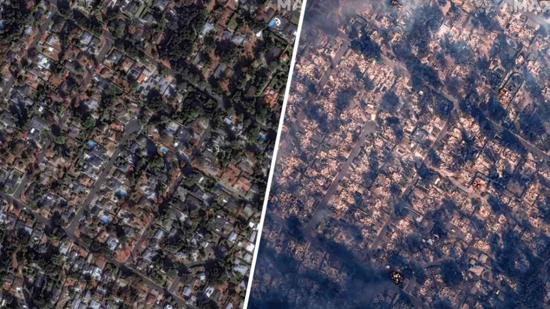
California Wildfire Devastation: Before-and-After Satellite Images Show Shocking Damage
The Eaton Fire in Altadena, California, has left a trail of destruction, with satellite images capturing the stark contrast in the affected area before and after the flames ravaged the land. The images, courtesy of Maxar, offer a chilling glimpse into the impact of the deadly wildfire that has engulfed over 10,000 acres of land in Los Angeles County.
A Community in Crisis
As the Eaton Fire rages on, hundreds of homes have been reduced to ashes, leaving families displaced and grappling with the aftermath of the disaster. The fire, fueled by Santa Ana winds, has presented a formidable challenge to firefighters who are working tirelessly to contain the blaze and protect critical infrastructure in the region.
A Race Against Time
Cal Fire has issued a red flag warning that remains in effect until Friday, signaling the continued threat posed by high wind conditions that are expected to persist until Thursday evening. The volatile combination of low humidity, dry fuels, and shifting winds has created an environment conducive to spot fires and rapid fire spread, necessitating vigilance and swift action from residents and authorities alike.
Standing Strong in the Face of Adversity
Amidst the devastation wrought by the Eaton Fire, the resilience and unity of the community have shone through. As families grapple with loss and uncertainty, the unwavering efforts of firefighters and emergency responders serve as a beacon of hope in the face of adversity. The road to recovery will undoubtedly be long and arduous, but with collective strength and support, the community will rise from the ashes and rebuild stronger than ever before.


